 vesseltracker.com
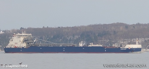
Vessel Algoma Sault IMO: 9619282, MMSI: 316036089 Self Discharging Bulk Carrier
UTC, 43.27337, -79.78719, course: 329, speed: 0
UTC, 43.27337, -79.78719, course: 329, speed: 0
2026-01-18 18:27:03 UTC, 43.27337, -79.78719, course: 329, speed: 0
Live AIS position:
UTC. Near Hannon),
updated 2026-01-18 18:27:03 UTC.
Find the position of the vessel Algoma Sault on the map. The latter are known coordinates and path.
marine traffic ship tracker show on live map
The current position of vessel Algoma Sault is 43.27337 lat / -79.78719 lng. Updated: 2026-01-18 18:27:03 UTCDetails:
Last coordinates of the vessel:
UTC, 43.27337, -79.78719, course: 329, speed: 0UTC, 43.27337, -79.78719, course: 329, speed: 0
UTC, 43.27337, -79.78719, course: 329, speed: 0
2026-01-18 18:27:03 UTC, 43.27337, -79.78719, course: 329, speed: 0