 vesseltracker.com
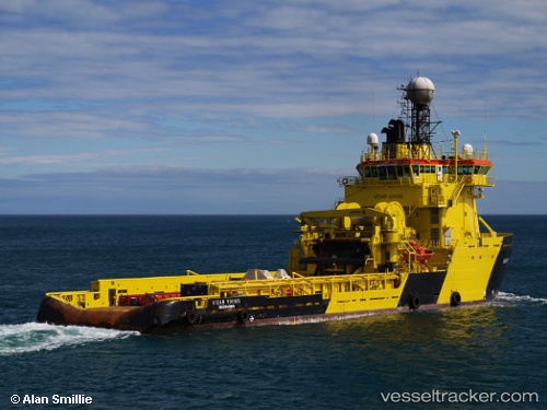
Vessel Captain Molly Kool IMO: 9199646, MMSI: 316038803 Offshore Tug Supply Ship
UTC, 47.55814, -52.70594, course: 50, speed: 0
UTC, 47.55833, -52.70667, course: -1, speed: 0
2026-03-01 03:37:04 UTC, 47.55814, -52.70594, course: 50, speed: 0
Live AIS position:
UTC. Near St. John’S),
updated 2026-03-01 03:37:04 UTC.
Find the position of the vessel Captain Molly Kool on the map. The latter are known coordinates and path.
marine traffic ship tracker show on live map
The current position of vessel Captain Molly Kool is 47.55814 lat / -52.70594 lng. Updated: 2026-03-01 03:37:04 UTCCurrently sailing under the flag of Canada
Captain Molly Kool built in 2001 year
Deadweight:
2600 tDetails:
Last coordinates of the vessel:
UTC, 47.55814, -52.70594, course: 50, speed: 0UTC, 47.55814, -52.70594, course: 50, speed: 0
UTC, 47.55833, -52.70667, course: -1, speed: 0
2026-03-01 03:37:04 UTC, 47.55814, -52.70594, course: 50, speed: 0