 vesseltracker.com
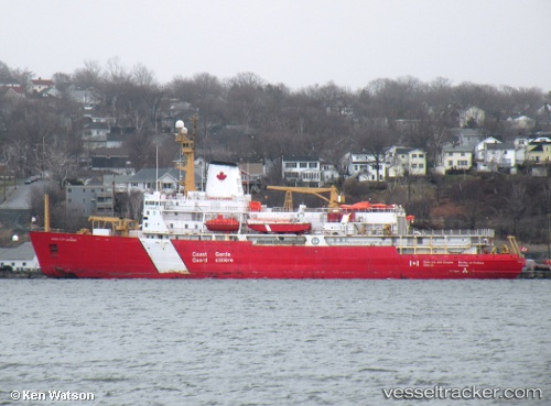
Vessel Louis S St Laurent IMO: 6705937, MMSI: 316165000 Icebreaker
UTC, 47.56971, -52.69586, course: 284, speed: 0
UTC, 47.56967, -52.69590, course: 284, speed: 0
2026-01-14 04:23:44 UTC, 47.56966, -52.69590, course: 283, speed: 0
Live AIS position:
UTC. Near St. John’S),
updated 2026-01-14 04:23:44 UTC.
Find the position of the vessel Louis S St Laurent on the map. The latter are known coordinates and path.
marine traffic ship tracker show on live map
The current position of vessel Louis S St Laurent is 47.56966 lat / -52.69590 lng. Updated: 2026-01-14 04:23:44 UTCCurrently sailing under the flag of Canada
Louis S St Laurent built in 1969 year
Deadweight:
4640 tDetails:
Last coordinates of the vessel:
UTC, 47.56966, -52.69590, course: 284, speed: 0UTC, 47.56971, -52.69586, course: 284, speed: 0
UTC, 47.56967, -52.69590, course: 284, speed: 0
2026-01-14 04:23:44 UTC, 47.56966, -52.69590, course: 283, speed: 0