 vesseltracker.com
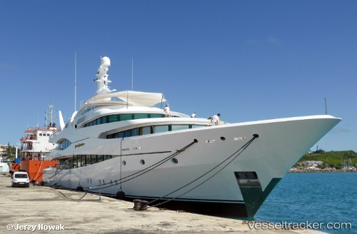
Vessel Lady Christine IMO: 1010698, MMSI: 319032500 Service Ship
UTC, 50.15333, -5.05167, course: -1, speed: 0
UTC, 50.15333, -5.05167, course: -1, speed: 0
2026-02-28 17:37:51 UTC, 50.15333, -5.05167, course: -1, speed: 0
Live AIS position:
UTC. Near Falmouth),
updated 2026-02-28 17:37:51 UTC.
Find the position of the vessel Lady Christine on the map. The latter are known coordinates and path.
marine traffic ship tracker show on live map
The current position of vessel Lady Christine is 50.15333 lat / -5.05167 lng. Updated: 2026-02-28 17:37:51 UTCDetails:
Last coordinates of the vessel:
UTC, 50.15333, -5.05167, course: -1, speed: 0UTC, 50.15333, -5.05167, course: -1, speed: 0
UTC, 50.15333, -5.05167, course: -1, speed: 0
2026-02-28 17:37:51 UTC, 50.15333, -5.05167, course: -1, speed: 0