 vesseltracker.com
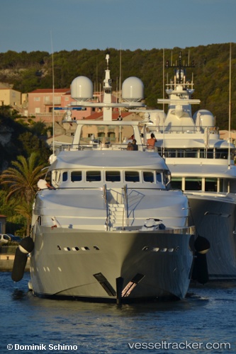
Vessel Deep Blue Ii IMO: 8736174, MMSI: 319041800 Service Ship
UTC, 44.35498, 8.56771, course: -1, speed: 0
UTC, 44.35504, 8.56786, course: -1, speed: 0
2026-03-09 14:01:38 UTC, 44.35495, 8.56779, course: -1, speed: 0
Live Vessel Deep Blue Ii Analytics (details, animations, etc.)
Live AIS position: UTC. Near VARAZZE), updated 2026-03-09 14:01:38 UTC.Find the position of the vessel Deep Blue Ii on the map. The latter are known coordinates and path.
marine traffic ship tracker show on live map
The current position of vessel Deep Blue Ii is 44.35495 lat / 8.56779 lng. Updated: 2026-03-09 14:01:38 UTCDetails:
Last coordinates of the vessel:
UTC, 44.35496, 8.56772, course: -1, speed: 0UTC, 44.35498, 8.56771, course: -1, speed: 0
UTC, 44.35504, 8.56786, course: -1, speed: 0
2026-03-09 14:01:38 UTC, 44.35495, 8.56779, course: -1, speed: 0