 vesseltracker.com
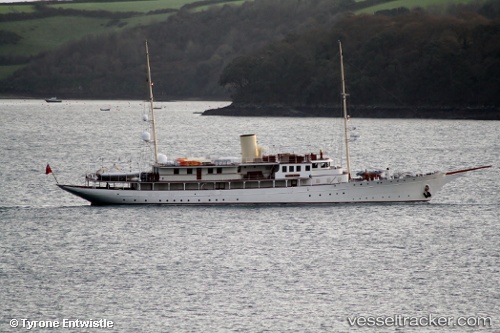
Vessel Haida 1929 IMO: 8981652, MMSI: 319080000 Yacht
UTC, -36.83903, 174.75308, course: 15, speed: 0
UTC, -36.83902, 174.75310, course: 15, speed: 0
2026-03-03 19:58:13 UTC, -36.83905, 174.75307, course: 15, speed: 0
Live AIS position:
UTC. Near WESTHAVEN),
updated 2026-03-03 19:58:13 UTC.
Find the position of the vessel Haida 1929 on the map. The latter are known coordinates and path.
marine traffic ship tracker show on live map
The current position of vessel Haida 1929 is -36.83905 lat / 174.75307 lng. Updated: 2026-03-03 19:58:13 UTCCurrently sailing under the flag of Cayman Is
Haida 1929 built in 1929 year
Details:
Last coordinates of the vessel:
UTC, -36.83906, 174.75305, course: 14, speed: 0.1UTC, -36.83903, 174.75308, course: 15, speed: 0
UTC, -36.83902, 174.75310, course: 15, speed: 0
2026-03-03 19:58:13 UTC, -36.83905, 174.75307, course: 15, speed: 0