 vesseltracker.com
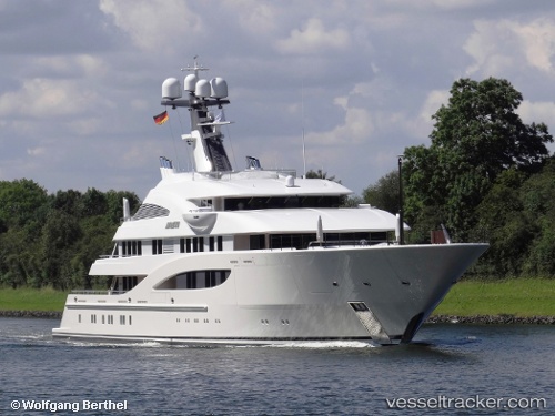
Vessel Amatasia IMO: 9734252, MMSI: 319115600 Passenger Ship
UTC, 18.46063, -66.09133, course: 101, speed: 0
UTC, 18.46065, -66.09133, course: 101, speed: 0
2026-01-17 22:30:12 UTC, 18.46063, -66.09133, course: 101, speed: 0.1
Live AIS position:
UTC. Near Puerta de Tierra),
updated 2026-01-17 22:30:12 UTC.
Find the position of the vessel Amatasia on the map. The latter are known coordinates and path.
marine traffic ship tracker show on live map
The current position of vessel Amatasia is 18.46063 lat / -66.09133 lng. Updated: 2026-01-17 22:30:12 UTCDetails:
Last coordinates of the vessel:
UTC, 18.46063, -66.09133, course: 101, speed: 0.1UTC, 18.46063, -66.09133, course: 101, speed: 0
UTC, 18.46065, -66.09133, course: 101, speed: 0
2026-01-17 22:30:12 UTC, 18.46063, -66.09133, course: 101, speed: 0.1