 vesseltracker.com
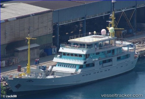
Vessel Tanit IMO: 1002249, MMSI: 319179000 Sailing Vessel
UTC, 18.18072, -76.45341, course: 33, speed: 0
UTC, 18.18076, -76.45343, course: 30, speed: 0
2026-02-03 08:53:14 UTC, 18.18076, -76.45343, course: 30, speed: 0
Live AIS position:
UTC. Near Port Antonio),
updated 2026-02-03 08:53:14 UTC.
Find the position of the vessel Tanit on the map. The latter are known coordinates and path.
marine traffic ship tracker show on live map
The current position of vessel Tanit is 18.18076 lat / -76.45343 lng. Updated: 2026-02-03 08:53:14 UTCDetails:
Last coordinates of the vessel:
UTC, 18.18086, -76.45343, course: 30, speed: 0UTC, 18.18072, -76.45341, course: 33, speed: 0
UTC, 18.18076, -76.45343, course: 30, speed: 0
2026-02-03 08:53:14 UTC, 18.18076, -76.45343, course: 30, speed: 0