 vesseltracker.com
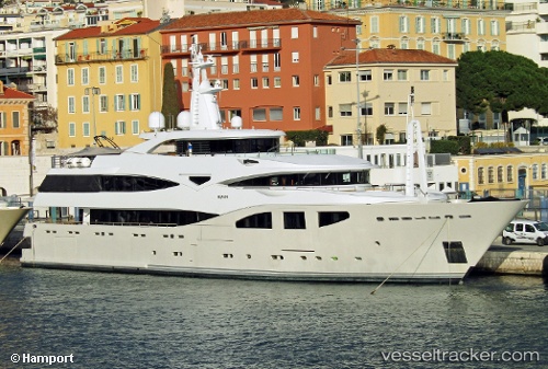
Vessel Maraya IMO: 1009455, MMSI: 319192000 Service Ship
UTC, 37.96047, 23.57671, course: 8, speed: 0
UTC, 37.96047, 23.57672, course: 8, speed: 0
2026-02-10 00:07:00 UTC, 37.96044, 23.57672, course: 8, speed: 0
Live AIS position:
UTC. Near PERAMA),
updated 2026-02-10 00:07:00 UTC.
Find the position of the vessel Maraya on the map. The latter are known coordinates and path.
marine traffic ship tracker show on live map
The current position of vessel Maraya is 37.96044 lat / 23.57672 lng. Updated: 2026-02-10 00:07:00 UTCCurrently sailing under the flag of Cayman Is
Maraya built in 2008 year
Deadweight:
137 tDetails:
Last coordinates of the vessel:
UTC, 37.96046, 23.57671, course: 8, speed: 0UTC, 37.96047, 23.57671, course: 8, speed: 0
UTC, 37.96047, 23.57672, course: 8, speed: 0
2026-02-10 00:07:00 UTC, 37.96044, 23.57672, course: 8, speed: 0