 vesseltracker.com
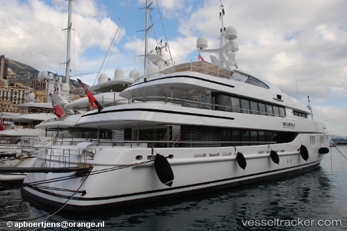
Vessel Netanya 8 IMO: 9416525, MMSI: 319278000 Service Ship
UTC, 26.77866, -80.05061, course: -1, speed: 0
UTC, 26.77863, -80.05061, course: -1, speed: 0
2026-03-25 04:16:33 UTC, 26.77865, -80.05061, course: -1, speed: 0
Live Vessel Netanya 8 Analytics (details, animations, etc.)
Live AIS position: UTC. Near Palm Beach), updated 2026-03-25 04:16:33 UTC.Find the position of the vessel Netanya 8 on the map. The latter are known coordinates and path.
marine traffic ship tracker show on live map
The current position of vessel Netanya 8 is 26.77865 lat / -80.05061 lng. Updated: 2026-03-25 04:16:33 UTCCurrently sailing under the flag of Cayman Is
Netanya 8 built in 2007 year
Deadweight:
130 tDetails:
Last coordinates of the vessel:
UTC, 26.77867, -80.05059, course: -1, speed: 0UTC, 26.77866, -80.05061, course: -1, speed: 0
UTC, 26.77863, -80.05061, course: -1, speed: 0
2026-03-25 04:16:33 UTC, 26.77865, -80.05061, course: -1, speed: 0