 vesseltracker.com
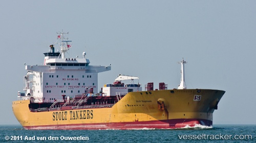
Vessel Stolt Sagaland IMO: 9352200, MMSI: 319282000 Chemical Oil Products Tanker
UTC, 19.66031, 72.46768, course: -1, speed: 12.3
UTC, 19.85603, 72.19876, course: -1, speed: 13
2026-02-27 12:31:15 UTC, 19.91333, 72.00667, course: -1, speed: 12
Live AIS position:
UTC. 44 nm W of Palghar),
updated 2026-02-27 12:31:15 UTC.
Find the position of the vessel Stolt Sagaland on the map. The latter are known coordinates and path.
marine traffic ship tracker show on live map
The current position of vessel Stolt Sagaland is 19.91333 lat / 72.00667 lng. Updated: 2026-02-27 12:31:15 UTCCurrently sailing under the flag of Cayman Is
Stolt Sagaland built in 2007 year
Deadweight:
44044 tDetails:
Last coordinates of the vessel:
UTC, 19.20333, 72.48333, course: -1, speed: 12UTC, 19.66031, 72.46768, course: -1, speed: 12.3
UTC, 19.85603, 72.19876, course: -1, speed: 13
2026-02-27 12:31:15 UTC, 19.91333, 72.00667, course: -1, speed: 12