 vesseltracker.com
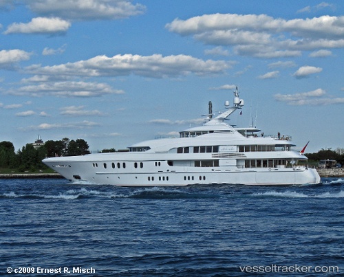
Vessel C Star IMO: 1008798, MMSI: 319597000 Service Ship
UTC, 25.00167, -77.50667, course: -1, speed: 0
UTC, 25.00167, -77.50667, course: -1, speed: 0
2026-02-05 05:29:14 UTC, 25.00167, -77.50667, course: -1, speed: 0
Live AIS position:
UTC. Near Lyford Cay),
updated 2026-02-05 05:29:14 UTC.
Find the position of the vessel C Star on the map. The latter are known coordinates and path.
marine traffic ship tracker show on live map
The current position of vessel C Star is 25.00167 lat / -77.50667 lng. Updated: 2026-02-05 05:29:14 UTCCurrently sailing under the flag of Cayman Is
C Star built in 2006 year
Deadweight:
217 tDetails:
Last coordinates of the vessel:
UTC, 25.00167, -77.50667, course: -1, speed: 0UTC, 25.00167, -77.50667, course: -1, speed: 0
UTC, 25.00167, -77.50667, course: -1, speed: 0
2026-02-05 05:29:14 UTC, 25.00167, -77.50667, course: -1, speed: 0