 vesseltracker.com
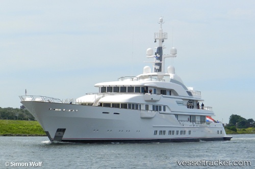
Vessel Hampshire 2 IMO: 1011599, MMSI: 319693000 Service Ship
UTC, 43.73576, 7.42755, course: 81, speed: 0
UTC, 43.73576, 7.42755, course: 81, speed: 0
2026-03-05 00:08:54 UTC, 43.73575, 7.42756, course: -1, speed: 0
Live Vessel Hampshire 2 Analytics (details, animations, etc.)
Live AIS position: UTC. Near Monaco), updated 2026-03-05 00:08:54 UTC.Find the position of the vessel Hampshire 2 on the map. The latter are known coordinates and path.
marine traffic ship tracker show on live map
The current position of vessel Hampshire 2 is 43.73575 lat / 7.42756 lng. Updated: 2026-03-05 00:08:54 UTCCurrently sailing under the flag of Cayman Is
Hampshire 2 built in 2012 year
Details:
Last coordinates of the vessel:
UTC, 43.73576, 7.42756, course: 81, speed: 0UTC, 43.73576, 7.42755, course: 81, speed: 0
UTC, 43.73576, 7.42755, course: 81, speed: 0
2026-03-05 00:08:54 UTC, 43.73575, 7.42756, course: -1, speed: 0