 vesseltracker.com
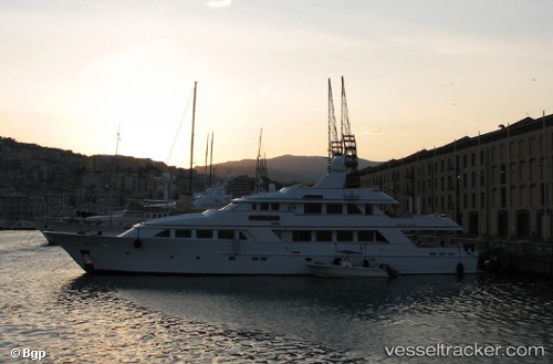
Vessel Lady J IMO: 8979269, MMSI: 319723000 Service Ship
UTC, 18.33596, -64.92094, course: 224, speed: 0
UTC, 18.33596, -64.92096, course: 224, speed: 0.1
2026-03-03 16:10:30 UTC, 18.33597, -64.92094, course: 224, speed: 0
Live AIS position:
UTC. Near ST THOMAS),
updated 2026-03-03 16:10:30 UTC.
Find the position of the vessel Lady J on the map. The latter are known coordinates and path.
marine traffic ship tracker show on live map
The current position of vessel Lady J is 18.33597 lat / -64.92094 lng. Updated: 2026-03-03 16:10:30 UTCCurrently sailing under the flag of Cayman Is
Details:
Last coordinates of the vessel:
UTC, 18.33595, -64.92093, course: 224, speed: 0UTC, 18.33596, -64.92094, course: 224, speed: 0
UTC, 18.33596, -64.92096, course: 224, speed: 0.1
2026-03-03 16:10:30 UTC, 18.33597, -64.92094, course: 224, speed: 0