 vesseltracker.com
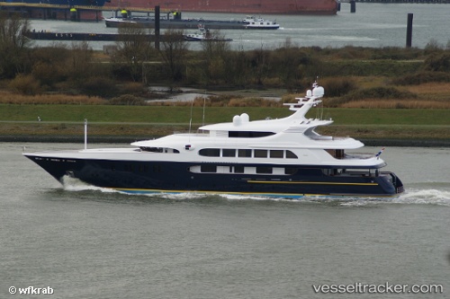
Vessel Tanusha IMO: 1010442, MMSI: 319949000 Service Ship
UTC, 36.75355, 28.92770, course: 134, speed: 0
UTC, 36.75355, 28.92770, course: 133, speed: 0
2026-03-02 19:43:13 UTC, 36.75355, 28.92770, course: 133, speed: 0
Live AIS position:
UTC. Near GOCEK),
updated 2026-03-02 19:43:13 UTC.
Find the position of the vessel Tanusha on the map. The latter are known coordinates and path.
marine traffic ship tracker show on live map
The current position of vessel Tanusha is 36.75355 lat / 28.92770 lng. Updated: 2026-03-02 19:43:13 UTCCurrently sailing under the flag of Cayman Is
Tanusha built in 2009 year
Deadweight:
629 tDetails:
Last coordinates of the vessel:
UTC, 36.75355, 28.92769, course: 134, speed: 0UTC, 36.75355, 28.92770, course: 134, speed: 0
UTC, 36.75355, 28.92770, course: 133, speed: 0
2026-03-02 19:43:13 UTC, 36.75355, 28.92770, course: 133, speed: 0