 vesseltracker.com
Find the position of the vessel Tanusha on the map. The latter are known coordinates and path.
marine traffic ship tracker show on live map
The current position of vessel Tanusha is 37.1117 lat / 27.2883 lng. Updated: 2024-05-06 20:56:58 UTCCurrently sailing under the flag of Cayman Is
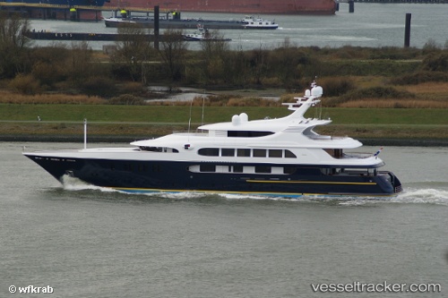
Tanusha built in 2009 year
Port of registry:
George Town (city situated on Grand Cayman island of the Cayman Islands; capital of the Cayman Islands)Deadweight:
629 tPayload_mass:
629 tonneGross tonnage:
1507Service entry:
2009-01-01T00:00:00ZManufacturer:
Koninklijke De Vries Scheepsbouw (shipyard in Aalsmeer, Netherlands)
Details:
Last coordinates of the vessel:
UTC, 37.1115, 27.2892, course: 232, speed: 0.1UTC, 37.1113, 27.2892, course: 275, speed: 0
UTC, 37.1117, 27.2883, course: -1, speed: 0
2024-05-06 20:56:58 UTC, 37.1117, 27.2883, course: -1, speed: 0