 vesseltracker.com
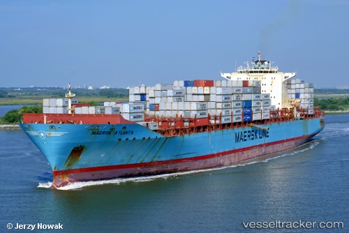
Vessel Maersk Atlanta IMO: 9348649, MMSI: 338078000 Container Ship
UTC, 40.67532, -74.14080, course: 310, speed: 0
UTC, 40.67533, -74.14079, course: 310, speed: 0
2026-02-11 00:21:43 UTC, 40.67534, -74.14078, course: 309, speed: 0
Live AIS position:
UTC. Near Maher Terminal),
updated 2026-02-11 00:21:43 UTC.
Find the position of the vessel Maersk Atlanta on the map. The latter are known coordinates and path.
marine traffic ship tracker show on live map
The current position of vessel Maersk Atlanta is 40.67534 lat / -74.14078 lng. Updated: 2026-02-11 00:21:43 UTCCurrently sailing under the flag of USA
Maersk Atlanta built in 2006 year
Deadweight:
84676 tDetails:
Last coordinates of the vessel:
UTC, 40.67533, -74.14080, course: 309, speed: 0UTC, 40.67532, -74.14080, course: 310, speed: 0
UTC, 40.67533, -74.14079, course: 310, speed: 0
2026-02-11 00:21:43 UTC, 40.67534, -74.14078, course: 309, speed: 0