 vesseltracker.com
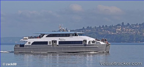
Vessel Doc Maynard IMO: 8793316, MMSI: 338224000 Passenger Ship
UTC, 47.60076, -122.33774, course: 272, speed: 0
UTC, 47.60112, -122.33989, course: 288, speed: 3.2
2026-02-27 15:45:21 UTC, 47.60127, -122.33911, course: 59, speed: 0
Live AIS position:
UTC. Near Interbay),
updated 2026-02-27 15:45:21 UTC.
Find the position of the vessel Doc Maynard on the map. The latter are known coordinates and path.
marine traffic ship tracker show on live map
The current position of vessel Doc Maynard is 47.60127 lat / -122.33911 lng. Updated: 2026-02-27 15:45:21 UTCCurrently sailing under the flag of USA
Details:
Last coordinates of the vessel:
UTC, 47.60075, -122.33773, course: 272, speed: 0UTC, 47.60076, -122.33774, course: 272, speed: 0
UTC, 47.60112, -122.33989, course: 288, speed: 3.2
2026-02-27 15:45:21 UTC, 47.60127, -122.33911, course: 59, speed: 0