 vesseltracker.com
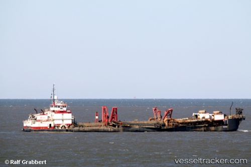
Vessel Bayport IMO: 8993784, MMSI: 338570000 Hopper Dredger
UTC, 27.45788, -80.32268, course: 251, speed: 0
UTC, 27.45790, -80.32267, course: 250, speed: 0
2026-03-02 17:58:04 UTC, 27.45787, -80.32264, course: 251, speed: 0
Live AIS position:
UTC. Near Saint Lucie),
updated 2026-03-02 17:58:04 UTC.
Find the position of the vessel Bayport on the map. The latter are known coordinates and path.
marine traffic ship tracker show on live map
The current position of vessel Bayport is 27.45787 lat / -80.32264 lng. Updated: 2026-03-02 17:58:04 UTCCurrently sailing under the flag of USA
Bayport built in 1996 year
Details:
Last coordinates of the vessel:
UTC, 27.45789, -80.32264, course: 251, speed: 0UTC, 27.45788, -80.32268, course: 251, speed: 0
UTC, 27.45790, -80.32267, course: 250, speed: 0
2026-03-02 17:58:04 UTC, 27.45787, -80.32264, course: 251, speed: 0