 vesseltracker.com
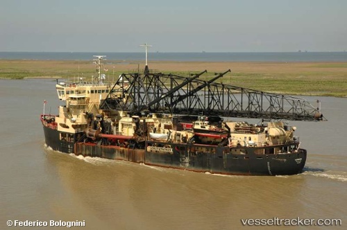
Vessel Mcfarland IMO: 7739856, MMSI: 338997000 Hopper Dredger
UTC, 39.87333, -75.20833, course: -1, speed: 0
UTC, 39.87333, -75.20833, course: -1, speed: 0
2026-03-03 03:50:36 UTC, 39.87333, -75.20833, course: -1, speed: 0
Live AIS position:
UTC. Near Colwyn),
updated 2026-03-03 03:50:36 UTC.
Find the position of the vessel Mcfarland on the map. The latter are known coordinates and path.
marine traffic ship tracker show on live map
The current position of vessel Mcfarland is 39.87333 lat / -75.20833 lng. Updated: 2026-03-03 03:50:36 UTCCurrently sailing under the flag of USA
Mcfarland built in 1966 year
Deadweight:
9754 tDetails:
Last coordinates of the vessel:
UTC, 39.87333, -75.20833, course: -1, speed: 0UTC, 39.87333, -75.20833, course: -1, speed: 0
UTC, 39.87333, -75.20833, course: -1, speed: 0
2026-03-03 03:50:36 UTC, 39.87333, -75.20833, course: -1, speed: 0