 vesseltracker.com
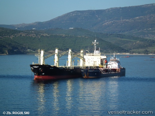
Vessel RUKIA IMO: 9136929, MMSI: 341294000 Bulk Carrier
UTC, 14.62411, -17.33228, course: -1, speed: 0
UTC, 14.62378, -17.33084, course: -1, speed: 0
2026-02-04 13:50:38 UTC, 14.62380, -17.33079, course: -1, speed: 0.1
Live AIS position:
UTC. Near Rufisque),
updated 2026-02-04 13:50:38 UTC.
Find the position of the vessel RUKIA on the map. The latter are known coordinates and path.
marine traffic ship tracker show on live map
The current position of vessel RUKIA is 14.62380 lat / -17.33079 lng. Updated: 2026-02-04 13:50:38 UTCCurrently sailing under the flag of St.Kitts and Nevis
RUKIA built in 1996 year
Deadweight:
23709 tDetails:
Last coordinates of the vessel:
UTC, 14.62365, -17.33106, course: -1, speed: 0.1UTC, 14.62411, -17.33228, course: -1, speed: 0
UTC, 14.62378, -17.33084, course: -1, speed: 0
2026-02-04 13:50:38 UTC, 14.62380, -17.33079, course: -1, speed: 0.1