 vesseltracker.com
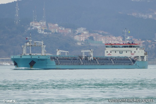
Vessel PETROBULK 1 IMO: 9643257, MMSI: 341355000 General Cargo Ship
UTC, 42.33500, 32.89500, course: -1, speed: 7
UTC, 42.33500, 32.89500, course: -1, speed: 7
2026-03-04 03:48:05 UTC, 42.33500, 32.89500, course: -1, speed: 7
Live Vessel PETROBULK 1 Analytics (details, animations, etc.)
Live AIS position: UTC. 26 nm N of Cide), updated 2026-03-04 03:48:05 UTC.Find the position of the vessel PETROBULK 1 on the map. The latter are known coordinates and path.
marine traffic ship tracker show on live map
The current position of vessel PETROBULK 1 is 42.33500 lat / 32.89500 lng. Updated: 2026-03-04 03:48:05 UTCCurrently sailing under the flag of St.Kitts and Nevis
PETROBULK 1 built in 2014 year
Deadweight:
7721 tDetails:
Last coordinates of the vessel:
UTC, 42.54667, 33.28333, course: -1, speed: 7UTC, 42.33500, 32.89500, course: -1, speed: 7
UTC, 42.33500, 32.89500, course: -1, speed: 7
2026-03-04 03:48:05 UTC, 42.33500, 32.89500, course: -1, speed: 7