 vesseltracker.com
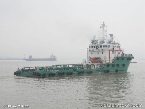
Vessel AQUA III IMO: 9363895, MMSI: 341470000 Offshore Supply Ship
UTC, 25.26438, 55.26204, course: 193, speed: 0
UTC, 25.26442, 55.26207, course: 193, speed: 0
2026-01-15 17:24:32 UTC, 25.26439, 55.26206, course: 193, speed: 0
Live AIS position:
UTC. Near DUBAI),
updated 2026-01-15 17:24:32 UTC.
Find the position of the vessel AQUA III on the map. The latter are known coordinates and path.
marine traffic ship tracker show on live map
The current position of vessel AQUA III is 25.26439 lat / 55.26206 lng. Updated: 2026-01-15 17:24:32 UTCCurrently sailing under the flag of St.Kitts and Nevis
AQUA III built in 2005 year
Deadweight:
1429 tDetails:
Last coordinates of the vessel:
UTC, 25.26440, 55.26207, course: 193, speed: 0UTC, 25.26438, 55.26204, course: 193, speed: 0
UTC, 25.26442, 55.26207, course: 193, speed: 0
2026-01-15 17:24:32 UTC, 25.26439, 55.26206, course: 193, speed: 0