 vesseltracker.com
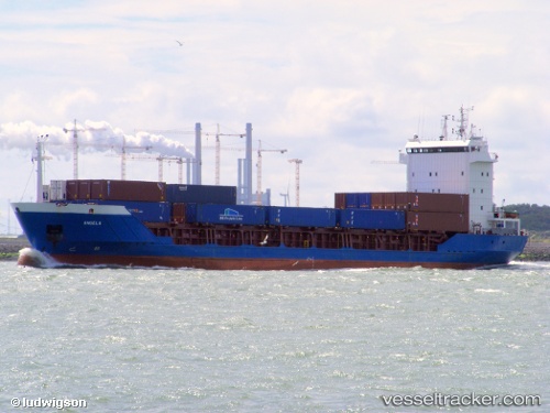
Vessel ANGELA IMO: 9071076, MMSI: 341534000 General Cargo Ship
UTC, 44.98078, 29.95644, course: 43, speed: 0.3
UTC, 44.98055, 29.95769, course: 2, speed: 0.1
2026-02-07 07:47:45 UTC, 44.98057, 29.95783, course: 0, speed: 0.1
Live AIS position:
UTC. 16 nm SE of Sulina (Port et Zone Franche)),
updated 2026-02-07 07:47:45 UTC.
Find the position of the vessel ANGELA on the map. The latter are known coordinates and path.
marine traffic ship tracker show on live map
The current position of vessel ANGELA is 44.98057 lat / 29.95783 lng. Updated: 2026-02-07 07:47:45 UTCCurrently sailing under the flag of St.Kitts and Nevis
ANGELA built in 1995 year
Deadweight:
4766 tDetails:
Last coordinates of the vessel:
UTC, 44.98082, 29.95636, course: 40, speed: 0.2UTC, 44.98078, 29.95644, course: 43, speed: 0.3
UTC, 44.98055, 29.95769, course: 2, speed: 0.1
2026-02-07 07:47:45 UTC, 44.98057, 29.95783, course: 0, speed: 0.1