 vesseltracker.com
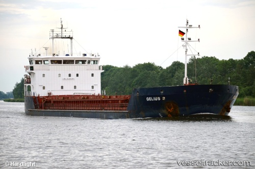
Vessel Gelmond 2 IMO: 9403487, MMSI: 341546000 General Cargo Ship
UTC, 44.73090, 37.80092, course: 5, speed: 0.1
UTC, 44.72285, 37.77677, course: 4, speed: 55.8
2026-02-05 17:18:18 UTC, 44.80274, 37.84042, course: 4, speed: 53
Live AIS position:
UTC. Near Novorossiysk),
updated 2026-02-05 17:18:18 UTC.
Find the position of the vessel Gelmond 2 on the map. The latter are known coordinates and path.
marine traffic ship tracker show on live map
The current position of vessel Gelmond 2 is 44.80274 lat / 37.84042 lng. Updated: 2026-02-05 17:18:18 UTCCurrently sailing under the flag of Saint Kitts and Nevis
Details:
Last coordinates of the vessel:
UTC, 44.73090, 37.80092, course: 5, speed: 0.1UTC, 44.73090, 37.80092, course: 5, speed: 0.1
UTC, 44.72285, 37.77677, course: 4, speed: 55.8
2026-02-05 17:18:18 UTC, 44.80274, 37.84042, course: 4, speed: 53