 vesseltracker.com
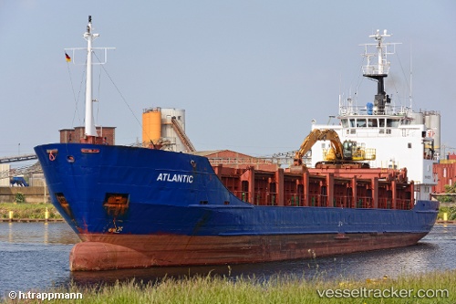
Vessel Atlantic IMO: 8002731, MMSI: 341565000 Aggregates Carrier
UTC, 12.04847, -61.76651, course: 92, speed: 0.1
UTC, 12.04827, -61.76650, course: 79, speed: 0
2026-03-01 05:54:11 UTC, 12.04867, -61.76637, course: 103, speed: 0.1
Live AIS position:
UTC. Near ST GEORGES),
updated 2026-03-01 05:54:11 UTC.
Find the position of the vessel Atlantic on the map. The latter are known coordinates and path.
marine traffic ship tracker show on live map
The current position of vessel Atlantic is 12.04867 lat / -61.76637 lng. Updated: 2026-03-01 05:54:11 UTCCurrently sailing under the flag of St Kitts Nevis
Atlantic built in 1980 year
Deadweight:
3041 tDetails:
Last coordinates of the vessel:
UTC, 12.04861, -61.76642, course: 102, speed: 0.1UTC, 12.04847, -61.76651, course: 92, speed: 0.1
UTC, 12.04827, -61.76650, course: 79, speed: 0
2026-03-01 05:54:11 UTC, 12.04867, -61.76637, course: 103, speed: 0.1