 vesseltracker.com
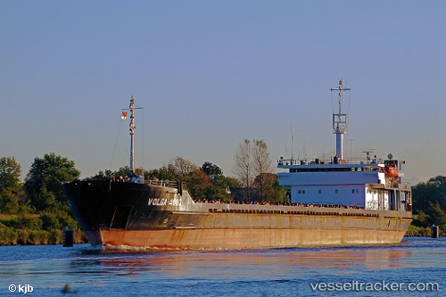
Vessel Volaris 52 IMO: 8624292, MMSI: 341648000 General Cargo Ship
UTC, 45.31072, 36.50644, course: 359, speed: 48
UTC, 45.31072, 36.50644, course: 359, speed: 48
2026-01-16 12:54:09 UTC, 45.31072, 36.50644, course: 359, speed: 48
Live AIS position:
UTC. Near Kerch),
updated 2026-01-16 12:54:09 UTC.
Find the position of the vessel Volaris 52 on the map. The latter are known coordinates and path.
marine traffic ship tracker show on live map
The current position of vessel Volaris 52 is 45.31072 lat / 36.50644 lng. Updated: 2026-01-16 12:54:09 UTCDetails:
Last coordinates of the vessel:
UTC, 45.31072, 36.50644, course: 359, speed: 48UTC, 45.31072, 36.50644, course: 359, speed: 48
UTC, 45.31072, 36.50644, course: 359, speed: 48
2026-01-16 12:54:09 UTC, 45.31072, 36.50644, course: 359, speed: 48