 vesseltracker.com
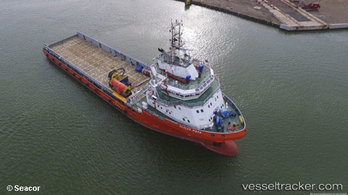
Vessel Seacor Maya IMO: 9701528, MMSI: 345070362 Offshore Tug Supply Ship
UTC, 19.61483, -92.27784, course: -1, speed: 5.8
UTC, 19.32333, -92.35667, course: -1, speed: 8
2026-03-02 21:21:32 UTC, 19.15402, -92.38873, course: 192, speed: 7.9
Live AIS position:
UTC. 27 nm S of Yùum K'Ak'Náab),
updated 2026-03-02 21:21:32 UTC.
Find the position of the vessel Seacor Maya on the map. The latter are known coordinates and path.
marine traffic ship tracker show on live map
The current position of vessel Seacor Maya is 19.15402 lat / -92.38873 lng. Updated: 2026-03-02 21:21:32 UTCCurrently sailing under the flag of Mexico
Details:
Last coordinates of the vessel:
UTC, 19.60500, -92.27333, course: -1, speed: 0UTC, 19.61483, -92.27784, course: -1, speed: 5.8
UTC, 19.32333, -92.35667, course: -1, speed: 8
2026-03-02 21:21:32 UTC, 19.15402, -92.38873, course: 192, speed: 7.9