 vesseltracker.com
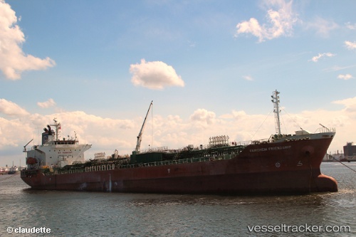
Vessel Sg Friendship IMO: 9288576, MMSI: 351322000 Chemical Oil Products Tanker
UTC, 34.47735, 133.98125, course: 90, speed: 0
UTC, 34.47755, 133.98120, course: 90, speed: 0.1
2026-02-07 05:42:24 UTC, 34.50557, 134.01141, course: 60, speed: 11.2
Live AIS position:
UTC. Near IEURA),
updated 2026-02-07 05:42:24 UTC.
Find the position of the vessel Sg Friendship on the map. The latter are known coordinates and path.
marine traffic ship tracker show on live map
The current position of vessel Sg Friendship is 34.50557 lat / 134.01141 lng. Updated: 2026-02-07 05:42:24 UTCCurrently sailing under the flag of Panama
Sg Friendship built in 2003 year
Deadweight:
19772 tDetails:
Last coordinates of the vessel:
UTC, 34.47752, 133.98116, course: 90, speed: 0UTC, 34.47735, 133.98125, course: 90, speed: 0
UTC, 34.47755, 133.98120, course: 90, speed: 0.1
2026-02-07 05:42:24 UTC, 34.50557, 134.01141, course: 60, speed: 11.2