 vesseltracker.com
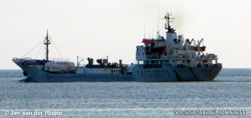
Vessel Islas Dos IMO: 7391783, MMSI: 351774000 Cement Carrier
UTC, 27.84260, -15.39932, course: -1, speed: 0
UTC, 27.84261, -15.39932, course: -1, speed: 0
2026-03-09 20:31:11 UTC, 27.84260, -15.39933, course: 39, speed: 0
Live Vessel Islas Dos Analytics (details, animations, etc.)
Live AIS position: UTC. Near ARINAGA), updated 2026-03-09 20:31:11 UTC.Find the position of the vessel Islas Dos on the map. The latter are known coordinates and path.
marine traffic ship tracker show on live map
The current position of vessel Islas Dos is 27.84260 lat / -15.39933 lng. Updated: 2026-03-09 20:31:11 UTCCurrently sailing under the flag of Panama
Islas Dos built in 1975 year
Deadweight:
5540 tDetails:
Last coordinates of the vessel:
UTC, 27.84261, -15.39932, course: -1, speed: 0UTC, 27.84260, -15.39932, course: -1, speed: 0
UTC, 27.84261, -15.39932, course: -1, speed: 0
2026-03-09 20:31:11 UTC, 27.84260, -15.39933, course: 39, speed: 0