 vesseltracker.com
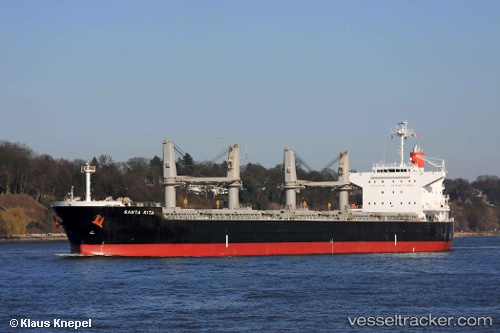
Vessel Santa Rita IMO: 9478999, MMSI: 351811000 Bulk Carrier
UTC, 34.89096, 136.72659, course: 346, speed: 0
UTC, 34.89102, 136.72693, course: 339, speed: 0
2026-02-03 04:15:24 UTC, 34.89116, 136.72723, course: 331, speed: 0
Live AIS position:
UTC. Near Yokkaichi),
updated 2026-02-03 04:15:24 UTC.
Find the position of the vessel Santa Rita on the map. The latter are known coordinates and path.
marine traffic ship tracker show on live map
The current position of vessel Santa Rita is 34.89116 lat / 136.72723 lng. Updated: 2026-02-03 04:15:24 UTCDetails:
Last coordinates of the vessel:
UTC, 34.89103, 136.72697, course: 338, speed: 0UTC, 34.89096, 136.72659, course: 346, speed: 0
UTC, 34.89102, 136.72693, course: 339, speed: 0
2026-02-03 04:15:24 UTC, 34.89116, 136.72723, course: 331, speed: 0