 vesseltracker.com
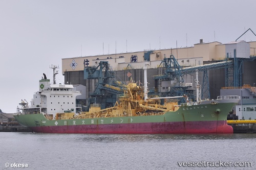
Vessel SEAVEN SKY IMO: 9142112, MMSI: 352001074 Cement Carrier
UTC, 36.25543, 22.34980, course: 91, speed: 10.3
UTC, 36.46532, 22.77894, course: 118, speed: 11.6
2026-02-01 08:09:10 UTC, 36.44414, 23.24130, course: 35, speed: 12.3
Live AIS position:
UTC. Near Neapolis),
updated 2026-02-01 08:09:10 UTC.
Find the position of the vessel SEAVEN SKY on the map. The latter are known coordinates and path.
marine traffic ship tracker show on live map
The current position of vessel SEAVEN SKY is 36.44414 lat / 23.24130 lng. Updated: 2026-02-01 08:09:10 UTCCurrently sailing under the flag of Panama
SEAVEN SKY built in 1996 year
Deadweight:
8461 tDetails:
Last coordinates of the vessel:
UTC, 36.51553, 21.97547, course: 135, speed: 11UTC, 36.25543, 22.34980, course: 91, speed: 10.3
UTC, 36.46532, 22.77894, course: 118, speed: 11.6
2026-02-01 08:09:10 UTC, 36.44414, 23.24130, course: 35, speed: 12.3