 vesseltracker.com
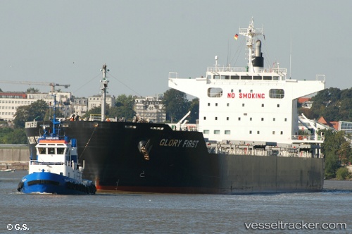
Vessel GLORY FIRST IMO: 9713909, MMSI: 352001142 Bulk Carrier
UTC, 18.81500, 70.07333, course: -1, speed: 12
UTC, 18.62189, 69.91613, course: 222, speed: 12.7
2026-01-15 11:36:21 UTC, 18.60853, 69.90388, course: 222, speed: 12.7
Live AIS position:
UTC. 136 nm S of Mul Dwårka),
updated 2026-01-15 11:36:21 UTC.
Find the position of the vessel GLORY FIRST on the map. The latter are known coordinates and path.
marine traffic ship tracker show on live map
The current position of vessel GLORY FIRST is 18.60853 lat / 69.90388 lng. Updated: 2026-01-15 11:36:21 UTCCurrently sailing under the flag of Panama
GLORY FIRST built in 2014 year
Deadweight:
77157 tDetails:
Last coordinates of the vessel:
UTC, 19.29518, 70.46994, course: 218, speed: 13.1UTC, 18.81500, 70.07333, course: -1, speed: 12
UTC, 18.62189, 69.91613, course: 222, speed: 12.7
2026-01-15 11:36:21 UTC, 18.60853, 69.90388, course: 222, speed: 12.7