 vesseltracker.com
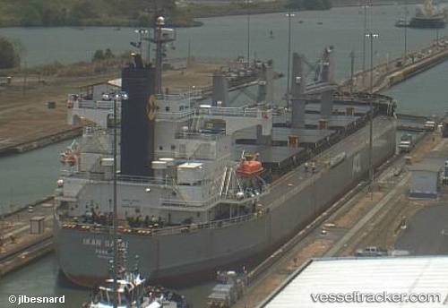
Vessel CEDAR IMO: 9403035, MMSI: 352001333 Bulk Carrier
UTC, 44.10194, 28.65881, course: 183, speed: 0
UTC, 44.10194, 28.65880, course: 183, speed: 0
2026-03-06 03:46:20 UTC, 44.10195, 28.65883, course: 183, speed: 0
Live Vessel CEDAR Analytics (details, animations, etc.)
Live AIS position: UTC. Near Agigea), updated 2026-03-06 03:46:20 UTC.Find the position of the vessel CEDAR on the map. The latter are known coordinates and path.
marine traffic ship tracker show on live map
The current position of vessel CEDAR is 44.10195 lat / 28.65883 lng. Updated: 2026-03-06 03:46:20 UTCCurrently sailing under the flag of Panama
CEDAR built in 2008 year
Deadweight:
58802 tDetails:
Last coordinates of the vessel:
UTC, 44.10192, 28.65880, course: 183, speed: 0UTC, 44.10194, 28.65881, course: 183, speed: 0
UTC, 44.10194, 28.65880, course: 183, speed: 0
2026-03-06 03:46:20 UTC, 44.10195, 28.65883, course: 183, speed: 0