 vesseltracker.com
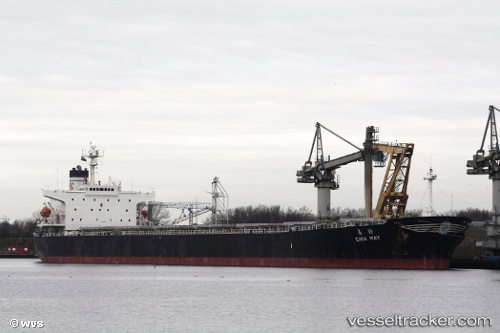
Vessel LUCKY JULIA IMO: 9138496, MMSI: 352001396 Bulk Carrier
UTC, 40.87511, 29.17571, course: 34, speed: 6.5
2026-03-18 07:59:47 UTC, 40.87511, 29.17571, course: 34, speed: 6.5
Live Vessel LUCKY JULIA Analytics (details, animations, etc.)
Live AIS position: UTC. Near Maltepe), updated 2026-03-18 07:59:47 UTC.Find the position of the vessel LUCKY JULIA on the map. The latter are known coordinates and path.
marine traffic ship tracker show on live map
The current position of vessel LUCKY JULIA is 40.87511 lat / 29.17571 lng. Updated: 2026-03-18 07:59:47 UTCCurrently sailing under the flag of Panama
LUCKY JULIA built in 1997 year
Deadweight:
74009 tDetails:
Last coordinates of the vessel:
UTC, 40.87511, 29.17571, course: 34, speed: 6.5UTC, 40.87511, 29.17571, course: 34, speed: 6.5
2026-03-18 07:59:47 UTC, 40.87511, 29.17571, course: 34, speed: 6.5