 vesseltracker.com
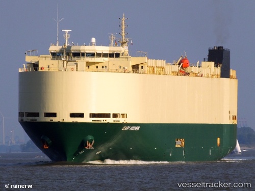
Vessel SILVER SKY IMO: 9448140, MMSI: 352001920 Vehicles Carrier
UTC, 34.18460, 125.28458, course: 137, speed: 17
UTC, 34.04100, 125.54110, course: 87, speed: 17.1
2026-01-15 07:23:34 UTC, 34.04633, 126.24572, course: 82, speed: 17.5
Live AIS position:
UTC. Near Chuja),
updated 2026-01-15 07:23:34 UTC.
Find the position of the vessel SILVER SKY on the map. The latter are known coordinates and path.
marine traffic ship tracker show on live map
The current position of vessel SILVER SKY is 34.04633 lat / 126.24572 lng. Updated: 2026-01-15 07:23:34 UTCCurrently sailing under the flag of Panama
SILVER SKY built in 2010 year
Deadweight:
12300 tDetails:
Last coordinates of the vessel:
UTC, 34.67425, 125.00998, course: 190, speed: 15.8UTC, 34.18460, 125.28458, course: 137, speed: 17
UTC, 34.04100, 125.54110, course: 87, speed: 17.1
2026-01-15 07:23:34 UTC, 34.04633, 126.24572, course: 82, speed: 17.5