 vesseltracker.com
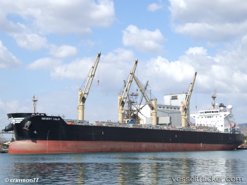
Vessel EASTERN MERCY IMO: 9543677, MMSI: 352001950 Bulk Carrier
UTC, 41.10348, 1.24302, course: 62, speed: 0
UTC, 41.10345, 1.24298, course: 62, speed: 0
2026-01-13 22:49:27 UTC, 41.10343, 1.24298, course: 62, speed: 0
Live AIS position:
UTC. Near Tarragona),
updated 2026-01-13 22:49:27 UTC.
Find the position of the vessel EASTERN MERCY on the map. The latter are known coordinates and path.
marine traffic ship tracker show on live map
The current position of vessel EASTERN MERCY is 41.10343 lat / 1.24298 lng. Updated: 2026-01-13 22:49:27 UTCCurrently sailing under the flag of Panama
EASTERN MERCY built in 2011 year
Deadweight:
57454 tDetails:
Last coordinates of the vessel:
UTC, 41.10341, 1.24302, course: 62, speed: 0UTC, 41.10348, 1.24302, course: 62, speed: 0
UTC, 41.10345, 1.24298, course: 62, speed: 0
2026-01-13 22:49:27 UTC, 41.10343, 1.24298, course: 62, speed: 0