 vesseltracker.com
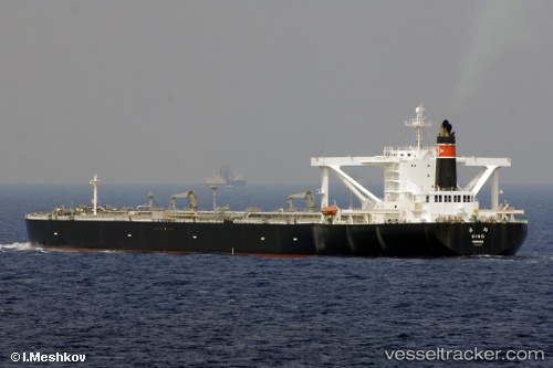
Vessel KIHO IMO: 9329796, MMSI: 352002628 Crude Oil Tanker
UTC, 1.28615, 104.03435, course: 232, speed: 6
UTC, 1.20266, 103.57105, course: 284, speed: 12.8
2026-03-04 07:41:57 UTC, 1.30537, 103.32375, course: 307, speed: 14.3
Live Vessel KIHO Analytics (details, animations, etc.)
Live AIS position: UTC. 14 nm W of TANJUNG PELEPAS), updated 2026-03-04 07:41:57 UTC.Find the position of the vessel KIHO on the map. The latter are known coordinates and path.
marine traffic ship tracker show on live map
The current position of vessel KIHO is 1.30537 lat / 103.32375 lng. Updated: 2026-03-04 07:41:57 UTCCurrently sailing under the flag of Panama
Details:
Last coordinates of the vessel:
UTC, 1.29746, 104.05908, course: 74, speed: 0.1UTC, 1.28615, 104.03435, course: 232, speed: 6
UTC, 1.20266, 103.57105, course: 284, speed: 12.8
2026-03-04 07:41:57 UTC, 1.30537, 103.32375, course: 307, speed: 14.3