 vesseltracker.com
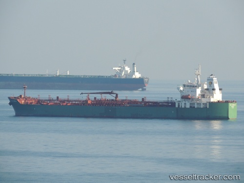
Vessel LEO MARIS IMO: 9381823, MMSI: 352002967 Oil/Chemical Tanker
UTC, 35.55802, 139.96812, course: -1, speed: 0.3
UTC, 35.55667, 139.96812, course: -1, speed: 0
2026-02-23 13:51:37 UTC, 35.55675, 139.96823, course: -1, speed: 0.1
Live AIS position:
UTC. Near ANEGASAKI),
updated 2026-02-23 13:51:37 UTC.
Find the position of the vessel LEO MARIS on the map. The latter are known coordinates and path.
marine traffic ship tracker show on live map
The current position of vessel LEO MARIS is 35.55675 lat / 139.96823 lng. Updated: 2026-02-23 13:51:37 UTCCurrently sailing under the flag of Panama
Details:
Last coordinates of the vessel:
UTC, 35.55908, 139.97058, course: -1, speed: 0.2UTC, 35.55802, 139.96812, course: -1, speed: 0.3
UTC, 35.55667, 139.96812, course: -1, speed: 0
2026-02-23 13:51:37 UTC, 35.55675, 139.96823, course: -1, speed: 0.1