 vesseltracker.com
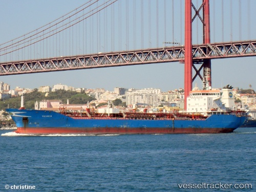
Vessel DAKAR IMO: 9251743, MMSI: 352003809 Chemical Oil Products Tanker
UTC, 44.55152, 37.96382, course: 138, speed: 4.4
UTC, 44.71910, 37.79676, course: 143, speed: 52.8
2026-01-15 13:56:49 UTC, 44.72711, 37.77512, course: 177, speed: 7.5
Live AIS position:
UTC. Near Novorossiysk),
updated 2026-01-15 13:56:49 UTC.
Find the position of the vessel DAKAR on the map. The latter are known coordinates and path.
marine traffic ship tracker show on live map
The current position of vessel DAKAR is 44.72711 lat / 37.77512 lng. Updated: 2026-01-15 13:56:49 UTCCurrently sailing under the flag of Panama
DAKAR built in 2004 year
Deadweight:
21297 tDetails:
Last coordinates of the vessel:
UTC, 44.89556, 38.05845, course: 317, speed: 7.6UTC, 44.55152, 37.96382, course: 138, speed: 4.4
UTC, 44.71910, 37.79676, course: 143, speed: 52.8
2026-01-15 13:56:49 UTC, 44.72711, 37.77512, course: 177, speed: 7.5