 vesseltracker.com
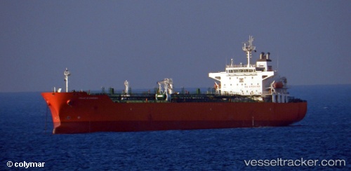
Vessel ELORA 1 IMO: 9295311, MMSI: 352005467 Oil/Chemical Tanker
UTC, 16.90516, 54.01427, course: -1, speed: 0
UTC, 16.90500, 54.01333, course: -1, speed: 0
2026-03-04 05:52:53 UTC, 16.90521, 54.01463, course: -1, speed: 0.1
Live AIS position:
UTC. Near Port Raysut),
updated 2026-03-04 05:52:53 UTC.
Find the position of the vessel ELORA 1 on the map. The latter are known coordinates and path.
marine traffic ship tracker show on live map
The current position of vessel ELORA 1 is 16.90521 lat / 54.01463 lng. Updated: 2026-03-04 05:52:53 UTCCurrently sailing under the flag of Panama
Details:
Last coordinates of the vessel:
UTC, 16.90500, 54.01333, course: -1, speed: 0UTC, 16.90516, 54.01427, course: -1, speed: 0
UTC, 16.90500, 54.01333, course: -1, speed: 0
2026-03-04 05:52:53 UTC, 16.90521, 54.01463, course: -1, speed: 0.1