 vesseltracker.com
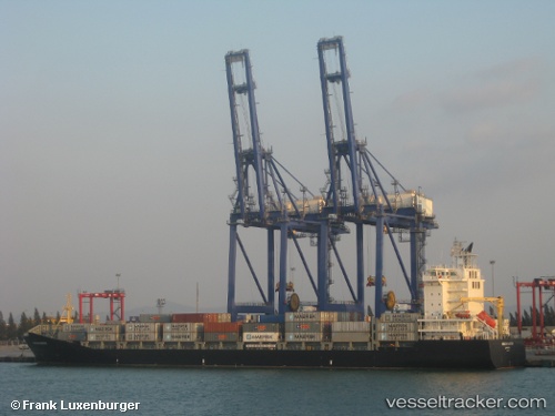
Vessel ERASMUS MASTER IMO: 9449833, MMSI: 352005886 Container Ship
UTC, 32.82527, 35.02689, course: 353, speed: 0
UTC, 32.86240, 34.99913, course: 298, speed: 12.4
2026-02-24 09:55:01 UTC, 32.96587, 34.62876, course: 289, speed: 12.5
Live AIS position:
UTC. 20 nm NW of Haifa Granaries),
updated 2026-02-24 09:55:01 UTC.
Find the position of the vessel ERASMUS MASTER on the map. The latter are known coordinates and path.
marine traffic ship tracker show on live map
The current position of vessel ERASMUS MASTER is 32.96587 lat / 34.62876 lng. Updated: 2026-02-24 09:55:01 UTCCurrently sailing under the flag of Panama
Details:
Last coordinates of the vessel:
UTC, 32.82527, 35.02688, course: 353, speed: 0UTC, 32.82527, 35.02689, course: 353, speed: 0
UTC, 32.86240, 34.99913, course: 298, speed: 12.4
2026-02-24 09:55:01 UTC, 32.96587, 34.62876, course: 289, speed: 12.5