 vesseltracker.com
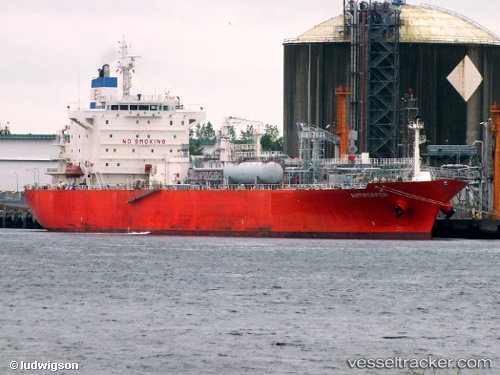
Vessel PASCO DUJA IMO: 9318321, MMSI: 352006215 Lpg Tanker
UTC, 25.22015, 56.35466, course: -1, speed: 0.6
UTC, 25.22015, 56.35466, course: -1, speed: 0.6
2026-03-17 07:23:24 UTC, 25.22015, 56.35466, course: -1, speed: 0.6
Live Vessel PASCO DUJA Analytics (details, animations, etc.)
Live AIS position: UTC. Near Al Fujayrah), updated 2026-03-17 07:23:24 UTC.Find the position of the vessel PASCO DUJA on the map. The latter are known coordinates and path.
marine traffic ship tracker show on live map
The current position of vessel PASCO DUJA is 25.22015 lat / 56.35466 lng. Updated: 2026-03-17 07:23:24 UTCCurrently sailing under the flag of Panama
Details:
Last coordinates of the vessel:
UTC, 25.21996, 56.35388, course: 336, speed: 0UTC, 25.22015, 56.35466, course: -1, speed: 0.6
UTC, 25.22015, 56.35466, course: -1, speed: 0.6
2026-03-17 07:23:24 UTC, 25.22015, 56.35466, course: -1, speed: 0.6