 vesseltracker.com
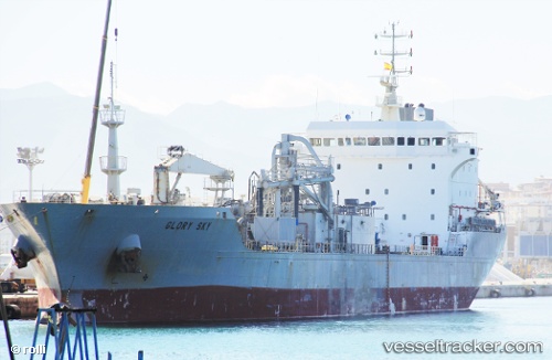
Vessel Glory Sky IMO: 9116527, MMSI: 352150000 Cement Carrier
UTC, 13.46015, 144.66312, course: 53, speed: 0
UTC, 13.46012, 144.66315, course: 54, speed: 0
2026-01-14 23:46:40 UTC, 13.46012, 144.66312, course: 54, speed: 0
Live AIS position:
UTC. Near Piti),
updated 2026-01-14 23:46:40 UTC.
Find the position of the vessel Glory Sky on the map. The latter are known coordinates and path.
marine traffic ship tracker show on live map
The current position of vessel Glory Sky is 13.46012 lat / 144.66312 lng. Updated: 2026-01-14 23:46:40 UTCCurrently sailing under the flag of Panama
Glory Sky built in 1996 year
Deadweight:
16265 tDetails:
Last coordinates of the vessel:
UTC, 13.46014, 144.66313, course: 53, speed: 0UTC, 13.46015, 144.66312, course: 53, speed: 0
UTC, 13.46012, 144.66315, course: 54, speed: 0
2026-01-14 23:46:40 UTC, 13.46012, 144.66312, course: 54, speed: 0