 vesseltracker.com
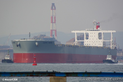
Vessel Cape Hope IMO: 9700823, MMSI: 352286000 Bulk Carrier
UTC, 34.35079, 133.72287, course: 250, speed: 11.5
UTC, 34.35079, 133.72287, course: 250, speed: 11.5
2026-02-27 02:22:27 UTC, 34.35079, 133.72287, course: 250, speed: 11.5
Live AIS position:
UTC. Near MARUGAME),
updated 2026-02-27 02:22:27 UTC.
Find the position of the vessel Cape Hope on the map. The latter are known coordinates and path.
marine traffic ship tracker show on live map
The current position of vessel Cape Hope is 34.35079 lat / 133.72287 lng. Updated: 2026-02-27 02:22:27 UTCCurrently sailing under the flag of Panama
Details:
Last coordinates of the vessel:
UTC, 34.35079, 133.72287, course: 250, speed: 11.5UTC, 34.35079, 133.72287, course: 250, speed: 11.5
UTC, 34.35079, 133.72287, course: 250, speed: 11.5
2026-02-27 02:22:27 UTC, 34.35079, 133.72287, course: 250, speed: 11.5