 vesseltracker.com
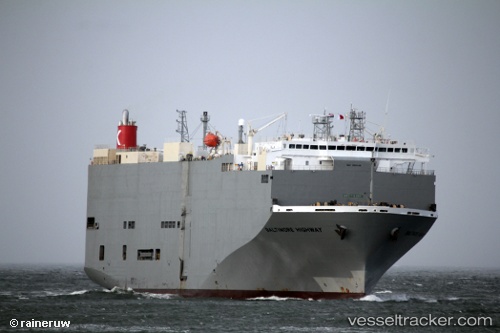
Vessel Baltimore Highway IMO: 9510149, MMSI: 352517000 Vehicles Carrier
UTC, 35.01213, 146.17934, course: 90, speed: 14.8
UTC, 35.02763, 146.90811, course: 90, speed: 15.2
2026-03-01 08:59:55 UTC, 35.03404, 147.28497, course: 85, speed: 15.5
Live AIS position:
UTC. 197 nm E of Santa Venera),
updated 2026-03-01 08:59:55 UTC.
Find the position of the vessel Baltimore Highway on the map. The latter are known coordinates and path.
marine traffic ship tracker show on live map
The current position of vessel Baltimore Highway is 35.03404 lat / 147.28497 lng. Updated: 2026-03-01 08:59:55 UTCCurrently sailing under the flag of Panama
Baltimore Highway built in 2009 year
Deadweight:
15341 tDetails:
Last coordinates of the vessel:
UTC, 34.99811, 145.78787, course: 86, speed: 14.9UTC, 35.01213, 146.17934, course: 90, speed: 14.8
UTC, 35.02763, 146.90811, course: 90, speed: 15.2
2026-03-01 08:59:55 UTC, 35.03404, 147.28497, course: 85, speed: 15.5