 vesseltracker.com
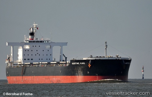
Vessel Maritime King IMO: 9574145, MMSI: 352695000 Bulk Carrier
UTC, -27.35275, 113.54786, course: 335, speed: 12.3
UTC, -27.35275, 113.54786, course: 335, speed: 12.3
2026-01-18 16:20:22 UTC, -27.18290, 113.45149, course: 333, speed: 12.1
Live AIS position:
UTC. 113 nm NW of Webberton),
updated 2026-01-18 16:20:22 UTC.
Find the position of the vessel Maritime King on the map. The latter are known coordinates and path.
marine traffic ship tracker show on live map
The current position of vessel Maritime King is -27.18290 lat / 113.45149 lng. Updated: 2026-01-18 16:20:22 UTCCurrently sailing under the flag of Panama
Maritime King built in 2011 year
Deadweight:
95675 tDetails:
Last coordinates of the vessel:
UTC, -27.54088, 113.65526, course: 335, speed: 12.2UTC, -27.35275, 113.54786, course: 335, speed: 12.3
UTC, -27.35275, 113.54786, course: 335, speed: 12.3
2026-01-18 16:20:22 UTC, -27.18290, 113.45149, course: 333, speed: 12.1