 vesseltracker.com
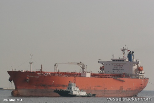
Vessel St. Gertrud IMO: 9400837, MMSI: 352709000 Oil Products Tanker
UTC, 59.78187, 28.42225, course: 208, speed: 0
UTC, 59.89467, 28.51082, course: 36, speed: 7.7
2026-02-07 15:35:22 UTC, 59.91362, 28.54112, course: 45, speed: 0
Live AIS position:
UTC. Near VISTINO),
updated 2026-02-07 15:35:22 UTC.
Find the position of the vessel St. Gertrud on the map. The latter are known coordinates and path.
marine traffic ship tracker show on live map
The current position of vessel St. Gertrud is 59.91362 lat / 28.54112 lng. Updated: 2026-02-07 15:35:22 UTCCurrently sailing under the flag of Panama
St. Gertrud built in 2009 year
Deadweight:
46622 tDetails:
Last coordinates of the vessel:
UTC, 59.78187, 28.42215, course: 208, speed: 0UTC, 59.78187, 28.42225, course: 208, speed: 0
UTC, 59.89467, 28.51082, course: 36, speed: 7.7
2026-02-07 15:35:22 UTC, 59.91362, 28.54112, course: 45, speed: 0