 vesseltracker.com
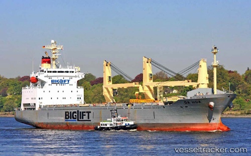
Vessel Da Hua IMO: 9153886, MMSI: 352773000 General Cargo Ship
UTC, -5.50966, 105.33668, course: 142, speed: 0
UTC, -5.50963, 105.33668, course: 143, speed: 0
2026-01-19 03:38:33 UTC, -5.50970, 105.33670, course: 142, speed: 0
Live AIS position:
UTC. Near Tarahan),
updated 2026-01-19 03:38:33 UTC.
Find the position of the vessel Da Hua on the map. The latter are known coordinates and path.
marine traffic ship tracker show on live map
The current position of vessel Da Hua is -5.50970 lat / 105.33670 lng. Updated: 2026-01-19 03:38:33 UTCCurrently sailing under the flag of Panama
Da Hua built in 1998 year
Deadweight:
16957 tDetails:
Last coordinates of the vessel:
UTC, -5.50965, 105.33668, course: 142, speed: 0UTC, -5.50966, 105.33668, course: 142, speed: 0
UTC, -5.50963, 105.33668, course: 143, speed: 0
2026-01-19 03:38:33 UTC, -5.50970, 105.33670, course: 142, speed: 0