 vesseltracker.com
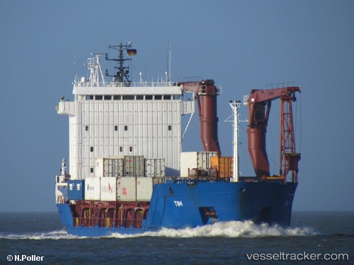
Vessel Yakoot IMO: 9143790, MMSI: 352965000 Multi Purpose Carrier
UTC, 36.88577, 6.91027, course: -1, speed: 0
UTC, 36.88580, 6.91028, course: -1, speed: 0
2026-03-03 17:40:17 UTC, 36.88573, 6.91028, course: -1, speed: 0
Live AIS position:
UTC. Near Skikid),
updated 2026-03-03 17:40:17 UTC.
Find the position of the vessel Yakoot on the map. The latter are known coordinates and path.
marine traffic ship tracker show on live map
The current position of vessel Yakoot is 36.88573 lat / 6.91028 lng. Updated: 2026-03-03 17:40:17 UTCCurrently sailing under the flag of Panama
Yakoot built in 1997 year
Deadweight:
4766 tDetails:
Last coordinates of the vessel:
UTC, 36.88577, 6.91029, course: -1, speed: 0UTC, 36.88577, 6.91027, course: -1, speed: 0
UTC, 36.88580, 6.91028, course: -1, speed: 0
2026-03-03 17:40:17 UTC, 36.88573, 6.91028, course: -1, speed: 0